
Satellite Intelligence in Agriculture is revolutionizing the way farmers monitor and manage their farms. With the help of satellite images, farmers can take timely decisions from anywhere without having to visit far-off locations.
Thanks to modern satellites’ ability to capture high-resolution photos and collect relevant information about farms, farmers are able to boost productivity while cutting costs.
What is Satellite Intelligence in Agriculture?
Satellite intelligence is the application of satellite imagery, remote sensing, and artificial intelligence to monitor agricultural activity on the ground.
Farmers can utilize this emerging technology to carry out various analyses such as:
- crop health
- moisture levels
- weather prediction
- pest control
- yield estimation
In addition, using these satellites, farmers can monitor large-scale farms efficiently.
How does Satellite Intelligence work?
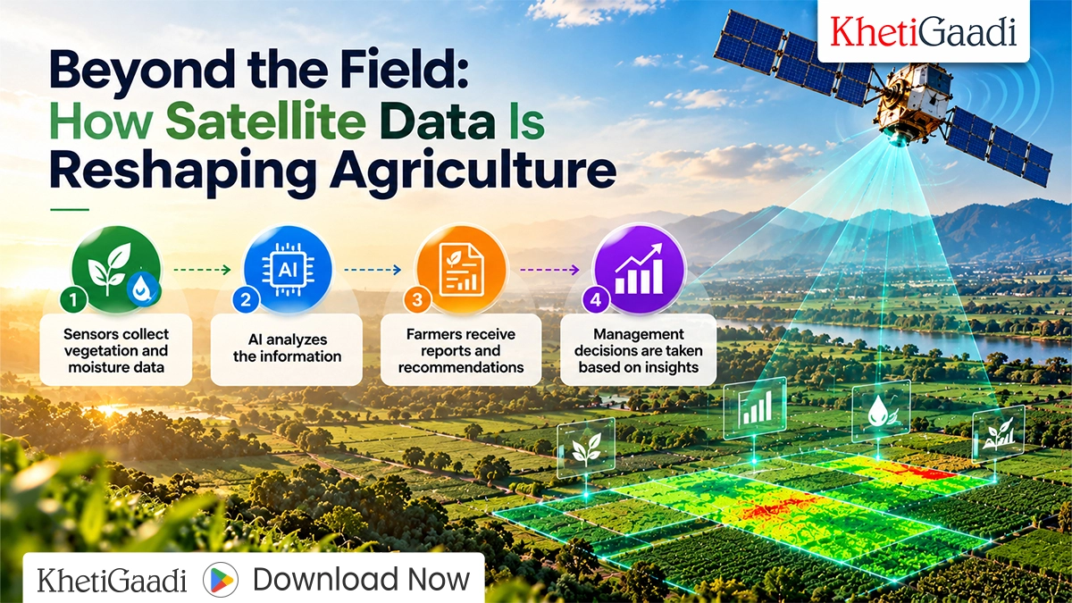
The satellites are equipped with sensors that scan agricultural lands from above the atmosphere. Moreover, the sensors detect data about crop vegetative health and moisture levels.
After gathering the information from the farms below, the satellites use artificial intelligence to analyze and interpret the data.
Farmers then use the findings to make critical business decisions.
Satellite intelligence works through the following steps:
- Taking pictures of the farms
- Sensors capturing crop and moisture data
- AI analyzing the information
- Farmers receiving reports
- Decision-making
In addition, satellite intelligence helps farmers make informed business decisions.
Benefits of Satellite Intelligence for Farmers
Improved crop monitoring
Using satellite imagery, farmers can easily identify unhealthy crops and respond accordingly. Thus, farmers benefit from increased yields because they can address problems in good time.
Better water management
Farmers have been facing water shortages in the past years. However, using satellite intelligence, farmers can monitor which crops need water and which ones do not.
Early disease detection
Most diseases are characterized by changes in crop color. Therefore, farmers can use satellite imagery to detect disease outbreaks in crops.
Improved yield estimation
Through yield estimation, farmers and agribusinesses can predict production volumes. Thus, agribusinesses can use the information to make better logistical arrangements.
Cutting costs
For example, farmers can use satellite imagery to apply fertilizers to specific regions that need them instead of the whole farm. Thus, this emerging technology can help farmers save significantly on farming inputs.
Satellite Intelligence vs Traditional Farm Monitoring
The below table compares the main differences between traditional farm monitoring and satellite intelligence.
| Features | Traditional Farm Monitoring | Satellite Intelligence |
|---|---|---|
| Field Inspection | Manual inspection | Visual scanning |
| Coverage | Limited | Wide |
| Data collection | Time-consuming | Real-time |
| Crop health analysis | Visual observation | AI-based analysis |
| Decision making | Reactive | Proactive |
| Cost efficiency | Moderate | High |
Main applications of satellite intelligence in agriculture
Precision farming
Precision farming is a technique that enables farmers to apply farm inputs depending on the needs of the farm region detected by the sensors. Thus, this new approach to farming increases productivity while reducing waste.
Drought monitoring
Satellite intelligence can help farmers identify the most affected areas during drought periods. In return, it can help farmers optimize their water usage accordingly.
Assessing soil health
Farmers can use satellite imagery to monitor the soil’s health and ensure they utilize it sustainably.
Carbon and sustainability monitoring
Satellite intelligence has become critical in helping government agencies and businesses stay within the set sustainability goals.
Challenges of satellite intelligence in agriculture
Satellite intelligence is still young and has several shortcomings, including:
High setup costs
Many farmers cannot afford the expensive equipment needed to monitor their farms using satellite technology.
Lack of access to technology
Some farmers still use traditional methods to monitor their farms due to limited access to technology.
Intermittent data connectivity
Data connectivity has been a problem in rural areas, limiting farmers’ ability to collect and share data with the satellites.
Lack of proper training
Farmers may buy the equipment but not utilize it efficiently because of the lack of proper skills.Technological advancements are making this new technology affordable and easier to use.
The future of satellite intelligence in farming
The future of agriculture is bright, thanks to the combination of satellite intelligence and artificial intelligence. Farming will become data-driven and automated to a great extent.For example, farmers will use drones to monitor their farms and collect data that will be used to make decisions automatically. Additionally, the application of artificial intelligence in predicting weather patterns and crop diseases will help farmers stay ahead of these problems.Therefore, the future of satellite intelligence in agriculture is promising. It has the potential to revolutionize the agricultural sector while promoting sustainability.
Final thoughts
Satellite intelligence is a powerful tool that can help farmers monitor and manage their farms efficiently. From the benefits, it can help farmers boost yields, optimize water usage, and improve farm management practices.
As more farmers adopt and apply it in different aspects of farming, it will become a game-changer in precision farming while promoting agricultural productivity in India.
Frequently Asked Questions (FAQ)
Q. What is satellite intelligence in agriculture?
Satellite intelligence is the use of satellite imagery, remote sensing, and artificial intelligence to monitor agricultural activity on the ground.
Q. How does satellite intelligence help farmers?
Satellite intelligence helps farmers monitor their farms and informs them of vital information, such as the most affected region, the most needy plants for fertilizers, and water management.
Q. Can satellite intelligence detect crop diseases?
Satellite intelligence can help farmers detect crop diseases and recommend the best intervention.
Q. Is satellite intelligence useful for small farmers?
With modern technology, many small farmers can use satellite intelligence to monitor their farms.
Q. Can satellite intelligence help increase crop yields?
Satellite intelligence can help farmers boost their yields while optimizing farm inputs.