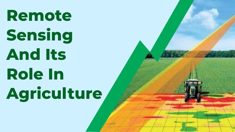
What is Remote Sensing?
Fundamentally, remote sensing entails inspecting terrain using sophisticated equipment from a great distance. The physical qualities of a plot of land are checked. By calculating the radiation that is produced and reflected by the land, the method builds a picture of the land and enables experts to assess certain areas of it.
Remote sensing is the process of learning information about an object or phenomenon without actually touching it. It is a phenomenon with several uses, such as in photography, surveying, geology, forestry, and many other fields. However, remote sensing has been used extensively in the sector of agriculture. Recently, there has been a surge in the use of cutting-edge technology in farming. Comparing modern agricultural procedures to traditional agrarian ones, they are noticeably more efficient, logical, and streamlined. A greater harvest and perfect production can be achieved by utilizing cutting-edge techniques in all facets of cultivation, such as crop yield estimation.
Farmers must take the best possible care of their crops in order to guarantee a higher yield. The monitoring of larger areas was constrained by the employment of customary systems because farmers were expected to physically visit every portion of the field. The most recent invention has provided a variety of techniques for farmers to control crop quality in larger regions without much of a stretch screen.
It is a type of remote sensing when farmers or ranchers look at their pastures or fields to judge their condition without touching them directly. The state of a plant can be assessed by looking at its leaves’ hues or general appearance. From a vantage point far above the field, remotely sensed images captured by satellites and aircraft offer a way to evaluate field conditions without actually touching them.
How can Remote Sensing help in Agriculture?
The identification of nutritional deficiencies, illnesses, water shortages or surpluses, weed infestations, insect damage, hail damage, wind damage, herbicide damage, and plant populations can all be done using remotely sensed images.
When applying fertilizers and pesticides at varying rates, remote sensing data can be used as a base map. Farmers can treat only the afflicted sections of a field using information from remotely sensed photographs. Before they may be seen visually, problems in a field may be detected remotely.
To find ideal grazing pastures, overgrazed areas, or areas with weed infestations, ranchers employ remote sensing. Lending institutions compare archival photos with those of nearby fields to determine the relative prices of land using remote sensing data.
Remote sensing has a wide range of uses in the agriculture industry. A list of these applications is provided below.
The use of remote sensing for agronomical research has many benefits. An important insight into the agronomic factors has come from the evaluation of crop canopies in agriculture. In crop classification, crop monitoring, and yield evaluation, remote sensing is crucial. Due to their extreme sensitivity to variations in soil, climate, and other physicochemical changes, the use of remote sensing is required in the field of agronomical research.
1. Crop production forecasting: It is used to anticipate crop yield and production across a specified area and to ascertain how much of the crop will be harvested under particular circumstances. The number of crops that will be produced in specific farmland over a specific time period can be predicted by researchers.
2. Crop damage and crop development: If there is crop damage or crop development, this technology can be utilized to penetrate the farmland and ascertain precisely how much of a specific crop has been damaged and the development of the remaining crop on the farm.
3. Horticulture, Cropping Systems Analysis: Cropping systems analysis in agriculture and horticulture has also benefited from the use of remote sensing technology. This technique has primarily been used in the horticulture sector, where it is possible to evaluate flower growth patterns and make predictions as a result.
4. Crop identification: Remote sensing has also been crucial in identifying crops, particularly when the crop being observed is enigmatic or exhibits other enigmatic traits. A variety of features of the crop, including the crop culture, are investigated in the laboratory using the data that was acquired from the crop.
5. Estimating the amount of farmland that has been planted with crops: Remote sensing has also been crucial in this process. Due to the enormous expanses of the areas being evaluated, this is typically a laborious process if done by hand.
6. Crop condition evaluation and stress detection: Remote sensing technology is crucial for determining each crop’s state of health as well as how well it has resisted stress. The crop’s quality is then assessed using this data.
7. Dates for planting and harvesting: Because remote sensing technology is predictive, farmers may now use it to study a number of parameters, such as weather patterns and soil types, in order to predict the planting and harvesting seasons of each crop.
8. Crop yield modeling and estimation: By measuring the quality of the crop and the size of the farmland, remote sensing also enables farmers and specialists to forecast the anticipated crop output from specific farmland. This is then used to calculate the crop’s anticipated overall yield.
9. Estimating soil moisture: Without the aid of remote sensing equipment, measuring soil moisture can be challenging. The amount of soil moisture is determined via remote sensing, which also aids in selecting the type of crop that can be planted there.
10. Monitoring and management of irrigation: Remote sensing provides data on the amount of soil moisture. This information aids in planning the soil’s irrigation requirements and is used to assess whether a certain soil is moisture deficient or not.
11. Lastly, observing and foreseeing climate change: By quantifying the temporal states of the oceans, land, and atmosphere, the remote sensing concept and its application in agriculture have made significant strides in our knowledge of climatic changes. Although there were other devices, they were not as accurate as this one in detecting meteorological and climatic changes. The weather has a significant impact on farming and agriculture and affects the production outcomes. As a result, this technology has proven to be a useful tool for making precise predictions about climate change.
To get the latest updates on the tractor, tractor price, and tractor news install the KhetiGaadi application.